GIS Research · Spatial Analysis · Yosemite National Park
Yosemite Search & Rescue
Examining how terrain and trail proximity relate to search and rescue incident patterns in Yosemite National Park.
Dylan Nordeck · University of Colorado Denver
Department of Geography & Environmental Sciences
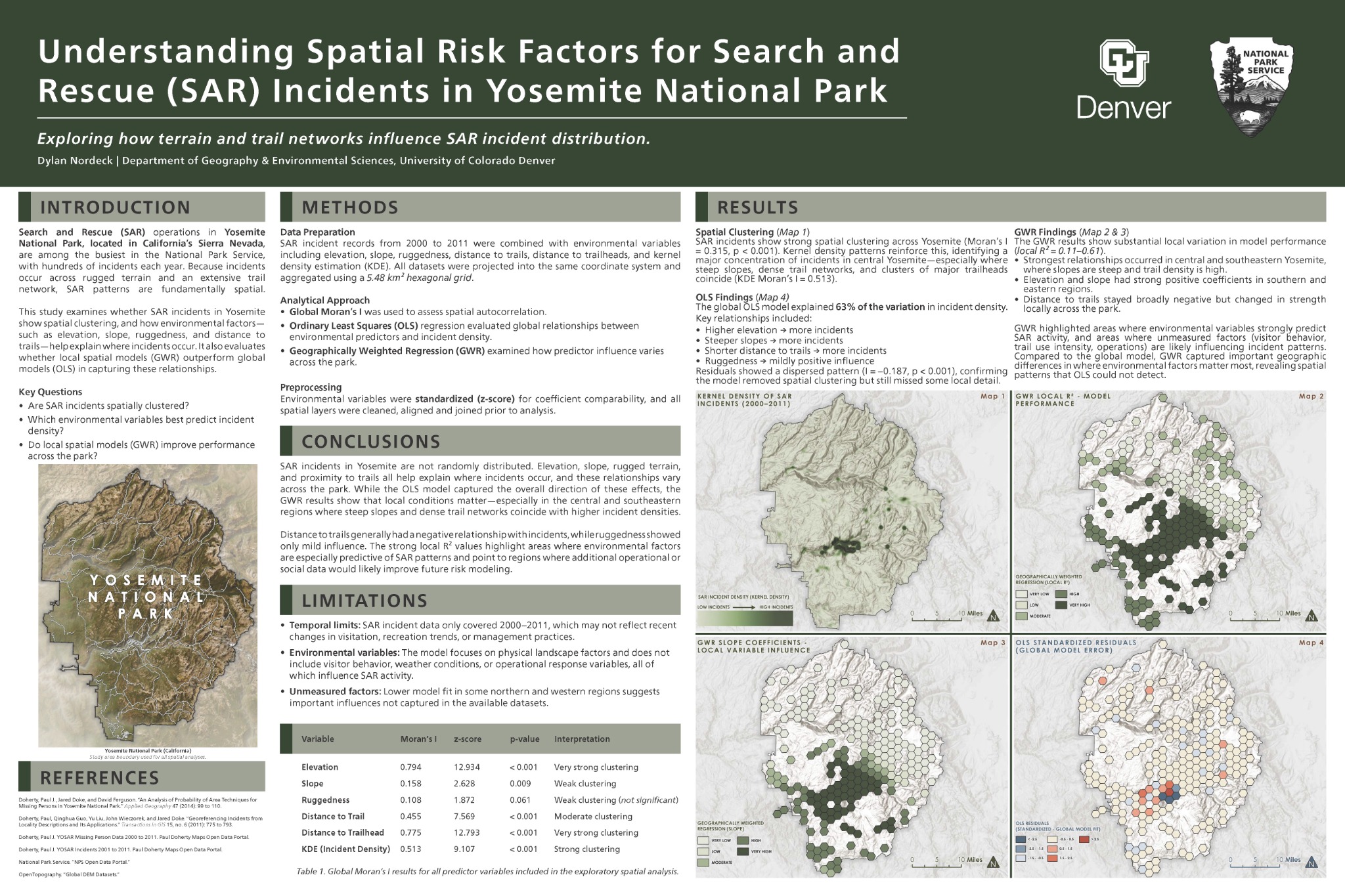 Open the full-size research poster ↗
The research
How do terrain and trail networks relate to where search and rescue incidents occur? This project tests spatial associations in Yosemite National Park and compares park-wide and local statistical models. The research was published in CU Denver’s Confluence in May 2026.
Methods
Using ArcGIS Pro, I aggregated 1,957 mapped YOSAR incidents into 218 hexagons of approximately 5.48 km². Paul Doherty’s source datasets cover incident records from 2001–2011 and missing-person records from 2000–2011. Terrain variables came from a 30-meter DEM, alongside straight-line distances to NPS trails and trailheads.
I standardized the environmental predictors and used Global Moran’s I to assess clustering. OLS modeled incident counts per hexagon across the study area; GWR explored local variation in those relationships. Kernel density estimation visualized incident concentrations and was not a regression predictor.
Key findings
Incidents were significantly clustered. The published OLS model reported an adjusted R² of 0.63, with higher elevation, steeper slopes, and proximity to trails associated with more incidents. These are spatial associations, not evidence that those factors caused individual incidents.
GWR added local detail but did not improve overall fit: its global adjusted R² was 0.375. Local R² values ranged from 0.11 to 0.61, with stronger fit in central and southeastern Yosemite and weaker fit in northern and western areas.
Limitations & next steps
The records are historical and may be incomplete. The models do not account for visitor exposure, behavior, weather, or seasonal patterns. Straight-line distances also simplify access across steep terrain, and results depend on the scale of the hexagonal grid.
Visitor-use data would help distinguish areas with more incidents because more people visit from areas with greater risk per visitor. A future risk-index map would require additional design and validation; this study provides an exploratory analysis of recorded incident patterns.