Wildlife Range Mapping · Terrain Visualization · Great Divide
Grizzly Ranges Along the Great Divide
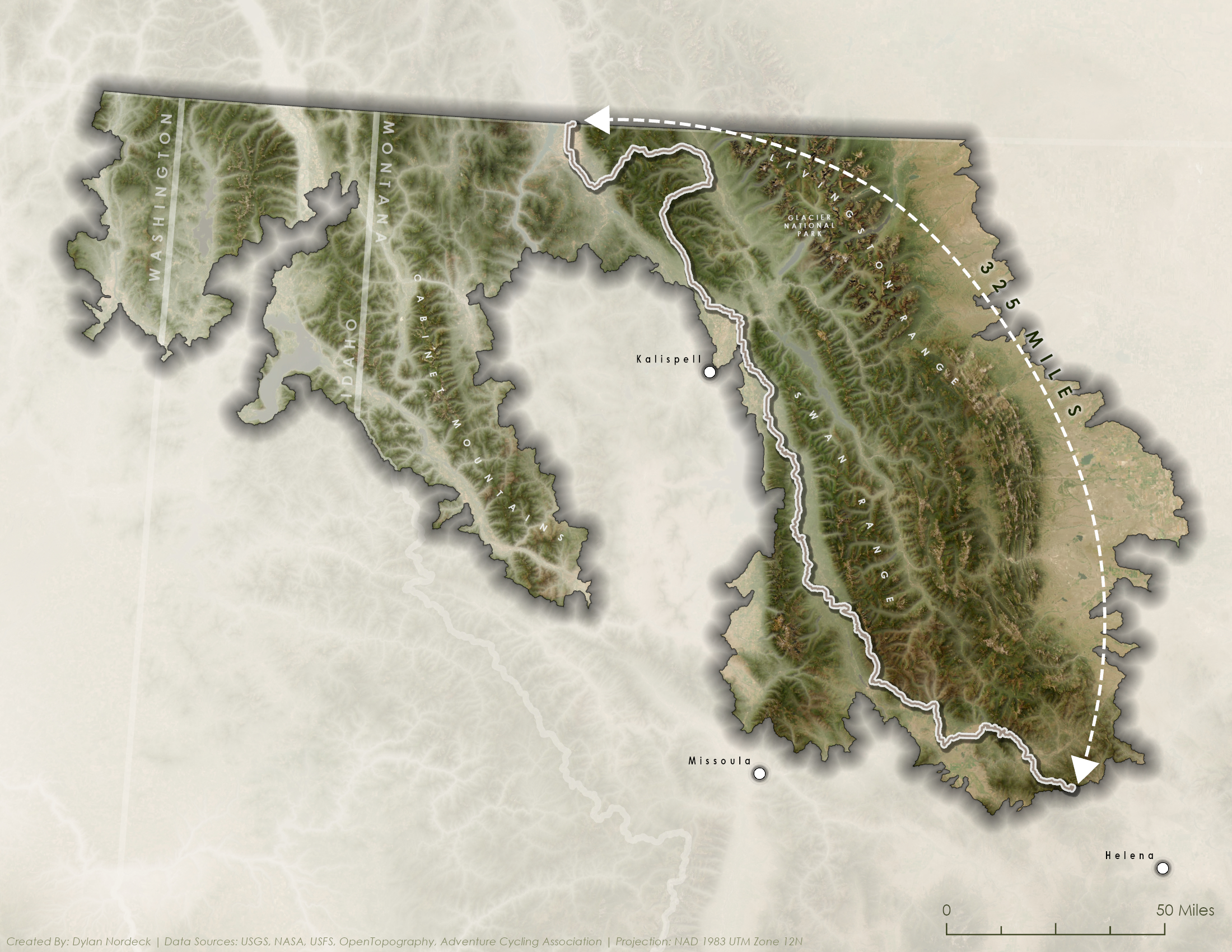
Mapping grizzly bear range alongside the Great Divide Mountain Bike Route in western Montana.
Dylan Nordeck · Cartography
 Open the full-size map ↗
01 / The project
This map is part of the wildlife and habitat section of my Great Divide atlas. I paired a broad overview of bear ranges in the West with closer views of the brown-bear regions along the route. This section focuses on the route through grizzly country in western Montana.
02 / Building the visual hierarchy
The light route line stands out against the darker relief inside the mapped bear-range area. This lets the route and wildlife geography be read together, while the shaded terrain adds context about the mountains the route passes through.
Place names, state boundaries, and a scale bar provide orientation. The lighter surrounding terrain keeps nearby geography visible while distinguishing it from the range area emphasized in the map.
03 / Terrain, color & type
Relief shading and muted greens and browns show the ridges and valleys within the mapped range. A strong edge and shadow separate that area from the pale surrounding landscape.
Labels identify places and features such as Kalispell, Missoula, Glacier National Park, and the Swan Range. Their spacing and contrast leave room for the terrain and route to remain visible.
04 / Part of a larger route story
The atlas examines the Great Divide through several themes, including elevation, wildlife, and seasonality. The bear maps add wildlife context to that broader route study, moving from a western overview to individual sections.
The mapped range provides regional context for the route. It does not identify individual bear sightings or predict encounters, and it is not a source of current trail or wildlife conditions.